
Milestone sea-level study examines the impact Greenland’s melting ice sheet
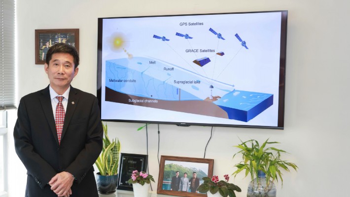
The rapid melting of the Greenland ice sheet, a crucial driver of rising sea levels, has prompted urgent scientific investigation. In a groundbreaking study, Professor Chen Jianli from PolyU’s Department of Land Surveying and Geo-informatics, and a core member of the Research Institute for Land and Space (RILS), led an international team of researchers using advanced satellite positioning data to reveal the dynamics of the ice sheet’s melt behaviour.
This research marks the first successful integration of modern space geodetic techniques to monitor vertical bedrock subsidence and quantify summer water storage within the Greenland ice sheet. The findings provide vital insights into the impact of ice sheets on global sea-level rise.
Around three kilometres thick, the Greenland ice sheet, is the second-largest ice mass on Earth. Its melting could trigger a seven-metre rise in average global sea levels. Yet, the underlying processes of water accumulation and release within the ice have remained largely unknown.
Satellite gravimetry, commonly used for such studies, is not optimal for regional assessment of Greenland hydrology. The research team pioneered the use of the Greenland GPS Network (GNET) and satellite gravity measurements from NASA’s Gravity Recovery and Climate Experiment. GNET, which includes numerous Global Navigation Satellite System (GNSS) stations, provided precise positioning data for their analysis.
Technology reveals meltwater storage patterns
By examining data captured between 2009 and 2015 by 22 GNSS stations located near bedrock and glacier outlets, the researchers detected patterns in regional meltwater storage and quantified the elastic deformation and subsidence of vertical bedrock. The findings indicate that during the summer melt season, meltwater is temporarily stored within the ice sheet, peaking in July before gradually decreasing, and leading to bedrock subsidence of up to five millimetres near the GNSS stations. Extreme melting in 2010 and 2012 led to subsidence of 12 and 14 millimetres, respectively.
The study also highlighted regional variations in the duration of meltwater storage, averaging about eight weeks, with nine weeks in the northeast and west, and around four and a half weeks in the south and southeast. As extreme summer temperatures become more frequent, accurate meltwater storage predictions will be crucial for sea-level assessments, suggesting that adjustments of up to 20% may be necessary for the warmest years.
Professor Chen emphasised that the study required years of preparation and expeditions to some of Earth’s most remote regions. “The significant results underscore the importance of extensive international cooperation in addressing climate change challenges,” he said, adding that the research would contribute to accurate model performance for warmer years, aiding ice-sheet behaviour and sea-level rise projections.
The study was published in the journal Nature. Read the full study here.
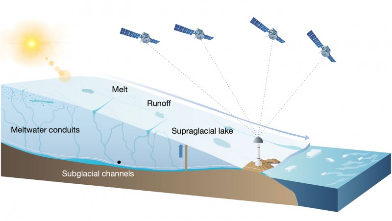
Pioneering new techniques quantify summer water storage in the Greenland ice sheet by analysing vertical bedrock shifts based on satellite positioning data.


